Have you ever wondered how scenes — from GPS trackers and connectivity channels to cloud platforms and software integrations?
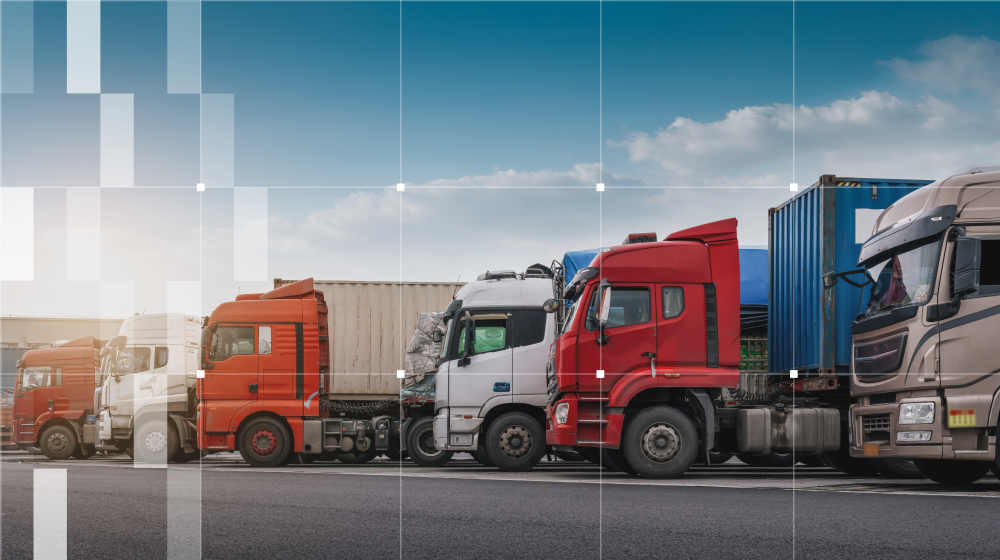
And it’s not just about local delivery. When a construction company monitors the location and fuel usage of its heavy equipment across multiple sites or a municipality tracks snowplows in real-time during a blizzard, the same core technology is at play.
Telematics is no longer a niche technology reserved for tech-savvy fleet operators or large-scale logistics giants. Today, whether it’s a delivery startup, a construction company, or a public service provider — any business with vehicles is, in some way, already touching the world of telematics. That shift is no accident. The digital transformation of fleet management has picked up speed, and with it, understanding how telematics systems function is becoming standard business knowledge.
So, what exactly is a telematics project in 2025? What does it look like at its simplest, and how can it scale in complexity based on a business's needs? In this article, we’ll break down a modern telematics project into its key components, starting from the basic setup and gradually expanding into the many layers that make these systems flexible, powerful, and highly customizable.
Basic telematics project scheme: a business view
How does a telematics project make its way into a business? Who puts all the pieces together?
-
A telematics service provider integrates the different components of the telematics ecosystem, ensuring that the hardware, connectivity, and software work seamlessly. They offer the expertise, integrations, and ongoing support businesses need to maximize their telematics solution.
-
Hardware goes for GPS tracking devices installed in vehicles. They gather essential data, such as location and speed, and integrate it with additional sensors to monitor numerous parameters.
-
Connectivity (SIM, satellite, or other networks) is the communication layer that transmits data from the GPS hardware to the software platform.
-
The software is where all collected data is processed, visualized, and transformed into meaningful insights. This is our lane at Gurtam; we make this software!
-
The business (fleet owner) is the end user of the telematics project who leverages the insights to improve efficiency, optimize operations, enhance safety, and reduce costs.
Now that we understand who delivers a telematics solution, how does a telematics project work technically?
Basic telematics project scheme: a tech view
Any telematics solution is built on a structured data flow, moving from hardware in the field to a software platform where it is processed and analyzed. 
Here’s how it works:
-
A GPS tracker captures real-time location data, speed, and direction. It may also collect inputs from additional sensors (temperature, cargo weight, driver behavior, etc.) depending on its capabilities.
-
Satellites provide the geolocation signals that GPS trackers use to determine their position.
-
The GPS tracker transmits its collected data through the connectivity layer (cellular, satellite, or alternative networks).
-
The software is where all incoming data is aggregated, processed, and visualized.
This simple framework forms the foundation of any telematics project. From here, the service providers can customize and scale the solutions by integrating additional technologies or refining data flows to meet specific operational goals.
Let’s explore some zones and levels of complexity that can be added to a telematics project.
What GPS trackers can do

GPS trackers collect location, speed, and direction at the most basic level, helping businesses monitor real-time movement and access historical data. As mentioned, they often collect data from additional sensors to capture a wide range of vehicle and environmental data (from fuel level monitoring to cargo temperature tracking).
For deeper vehicle diagnostics, some GPS trackers connect to onboard vehicle systems using OBD (On-Board Diagnostics) and CAN bus (Controller Area Network — a system allowing different vehicle components to communicate electronically). These interfaces provide access to vehicle data.

CAN bus is often used not only for telematics purposes but also for maintenance and diagnostics of the vehicles
In short, GPS trackers are not one-size-fits-all. From simple plug-and-play OBD devices to advanced hardwired units supporting multiple sensor inputs and vehicle integrations, the choice of tracker depends on the depth of data required and the level of operational control a business seeks.
How connectivity helps more complex telematics projects
No matter how advanced a GPS tracker is, it’s only as effective as its ability to transmit data. Connectivity is the link that ensures real-time tracking, data transfer, and remote control functions. The right choice of connectivity depends on the operational environment and the business requirements.
-
-
For most fleet management applications, GSM (cellular networks like 2G, 3G, 4G, and increasingly 5G) is the standard. It provides fast, reliable data transmission in urban and suburban areas.
-
However, satellite communication becomes the best option in remote areas, mining sites, or offshore operations, where cellular coverage is weak or nonexistent. While satellite tracking is more expensive, it ensures uninterrupted connectivity regardless of location.
-
Other technologies cater to specific use cases. LoRa (Long Range) networks are used for low-power, long-distance tracking, making them suitable for asset monitoring in large industrial facilities, agriculture, smart cities, supply chain and logistics, and railway transportation.
-
Bluetooth and Wi-Fi play a role in short-range tracking, often used for in-yard fleet management or warehouse logistics. Other technologies like BLE, used in beacons for indoor asset tracking or pallet monitoring, support similar short-range applications, while narrowband IoT enables low-power, long-range connectivity for use cases such as tracking shipping containers or monitoring remote equipment health.
-
Businesses can use multi-SIM trackers that switch between networks to ensure reliable connectivity. They can also partner with fleet-focused connectivity providers that offer solutions like eSIMs with combined cellular and satellite coverage and access to hundreds of networks across regions.
Telematics platforms and beyond
A tracking system is the software layer of a telematics project where all collected data is processed, visualized, and turned into actionable insights.
At their core, these systems gather information from GPS trackers and sensors, organize it through dashboards, maps, and reports, and ensure seamless data transfer to other business tools when needed.
They, too, can take various forms.
Some are cloud-based solutions that offer real-time access from any device. Others may be on-premises systems tailored for organizations with strict data governance or security requirements.
Certain platforms are built for specific industries — like logistics, construction, or cold chain — and include specialized features. Some are universal and designed for general use.
More advanced platforms may incorporate AI-powered analytics, predictive maintenance alerts, and customizable dashboards that allow businesses to drill down into granular operational metrics. In contrast, others offer out-of-the-box simplicity for smaller fleets that just need basic tracking and reporting.
Third-party apps and customizations
A telematics system doesn’t operate in isolation — it often needs to communicate with other business tools to maximize its impact. Third-party apps and custom integrations allow businesses to expand the capabilities of their tracking systems.
Whether it’s integrating with ERP software, dispatch platforms, or compliance solutions, modern telematics platforms are built to share data across different environments seamlessly. An API acts as a bridge, enabling telematics platforms to exchange data with virtually any other software. For example, businesses can use APIs to automatically feed fleet tracking data into logistics management systems, ensuring precise ETAs for deliveries.
SDKs, on the other hand, allow developers to customize tracking platforms by adding new features, modifying reports, or creating specialized interfaces tailored to specific industries.
Sending commands to the vehicles
Telematics isn't just about collecting data — it also enables businesses to take action remotely if the installed software and hardware offer this functionality.
For example, if a vehicle is reported stolen or used outside approved hours, an operator can remotely shut down the engine, preventing further movement. A warning alarm can be triggered if unsafe driving behavior — such as excessive idling, harsh braking, or speeding — is detected. Remote commands can lock doors, enable or disable specific vehicle functions, or adjust onboard settings.
Video telematics
Video telematics has become a game-changer for fleet management, adding visual context to traditional tracking data.
For example, if a harsh braking event is detected, a video clip can be automatically uploaded to the fleet management platform, providing critical context — was it reckless driving, or did the driver avoid an accident?
However, video introduces additional challenges, particularly with connectivity and storage. High-quality footage requires substantial bandwidth, so many systems use intelligent event-based recording — only transmitting clips when specific triggers (like collisions or sudden accelerations) occur instead of continuously streaming.
AI-powered cameras further optimize this by analyzing footage in real-time, detecting distractions, drowsiness, or phone use, and sending alerts without requiring constant human monitoring.
Сonnected mobility
Connected mobility is essentially an extension of telematics but with a broader scope beyond traditional fleet tracking. While telematics focuses primarily on monitoring and managing vehicles, connected mobility integrates multiple modes of transportation, smart city infrastructure, and shared mobility solutions into a unified ecosystem. This means not just tracking where a vehicle is but also how it interacts with other systems, such as traffic management platforms, public transit networks, and even mobility-as-a-service (MaaS) applications.
The fundamental telematics framework remains largely the same, but the data flows and decision-making processes are more dynamic.
Gurtam at the heart of telematics projects

Behind every successful telematics project, there’s an ecosystem of hardware manufacturers, connectivity providers, software developers, and all the other components we’ve mentioned across the article — and Gurtam sits at the center of it all. Supported by decades of experience in fleet digitalization, our products, Wialon, flespi, and GPS-Trace, serve as the backbone for telematics service providers, enabling them to build customized solutions tailored to industries ranging from logistics and public transportation to construction and agriculture.
Wialon is an ultimate fleet digitalization platform.
flespi is an API-first telematics & IoT backend that bridges GPS hardware and various software applications.
Designed for smaller-scale tracking, GPS-Trace is a platform that caters to individual users and small fleets.
What makes Gurtam unique is our ability to bring together all the moving parts of a telematics project on a software level. We work closely with device manufacturers, collaborate with connectivity providers and software developers, and build strong communities of telematics professionals.
By providing the technology and expertise that link these components together, Gurtam ensures that businesses of all sizes can unlock the full potential of telematics — from basic tracking to the most advanced fleet management solutions.
👉 To stay in the loop on industry trends, product updates, and expert insights into the future of fleet management, be sure to subscribe to our newsletter — we’re here to keep you informed and ahead of the curve.